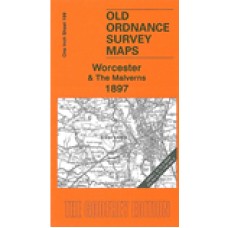
One Inch Sheet 199 Worcester & The Malverns 1897 - published 2006; introduction Malcolm Nixon
This Inch to the Mile map covers much of south Worcestershire together with part of Herefordshire, with Worcester and the Malvern Hills quite central features of the map. Coverage stretches from Acton Beauchamp eastward to Pershore, and from Worcester southward to Upton on Severn. The map is an excellent accompaniment to our larger scale maps for the Malverns and Worcester. On the reverse we include a detailed map of Upton on Severn town centre.
Worcester and The Malverns 1897 - Old Ordnance Survey Maps - The Godfrey Edition
- Brand: Alan Godfrey Maps
- Product Code: E199
- Availability: 1
-
£3.50
Related Products
Upton On Severn St. Peter St. Paul (Old Churchyard Pre 1879 Only) - Monumental Inscriptions - Download
Monumental Inscriptions Upton On Severn, St. Peter St. Paul (Old Churchyard Pre 1879 Only) The..
£1.50


